


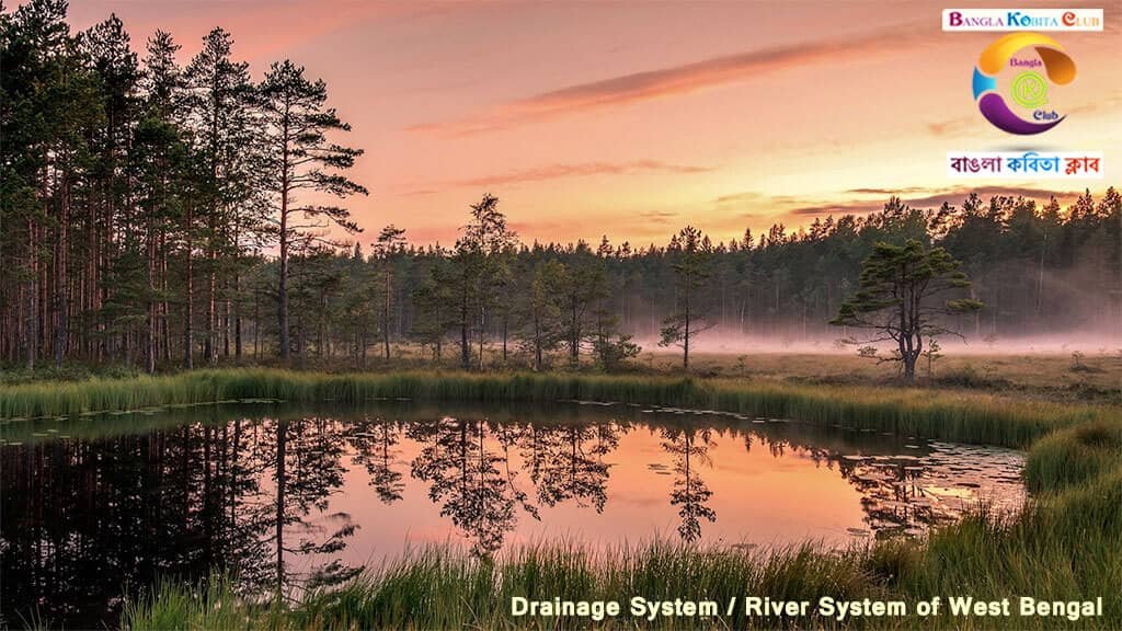
In this tutorial, we had discussed the Drainage System / River System of West Bengal.
The land of West Bengal is full of rivers. The Ganges and its tributaries run throughout West Bengal which helps to irrigate the fertile deltaic region. Even the state has perennial and non-perennial rivers, lakes and waterfalls.
The streams, rivers, and lakes in a particular drainage basin form the patterns is called the Drainage systems or River systems. West Bengal has an excellent river system or drainage system as it is well-drained by several rivers. Most of the rivers are full to the edge during the monsoon. The lower reaches of all the rivers of the region flow through India and Bangladesh, whereas their upper courses flow through Nepal and Bhutan.
I. RIVERS OF WEST BENGAL
The rivers of West Bengal are divided into four categories based on their source and nature of the flow. These are as follows:
01. Rivers of North Bengal
02. Ganga and its Tributaries
03. Rivers of Western Plateau
04. Rivers of South or Sundarbans Bengal
(01) RIVERS OF NORTH BENGAL
The rivers primarily originate in Himalayan mountains and gradually flow from North to South direction in the state are categorised them as rivers of North Bengal. Generally, these rivers are perennial which means they have water throughout the year. They are also called Snowfed rivers due to their formation by the melting of ice.
The major and important rivers of the Northern Bengal are Mahananda, Teesta, Torsa, Jaldhaka, Kaljani, and Raidak. These are discussed below:
A. MAHANANDA RIVER
• Origin: Mahananda river originates from the Mahaldhiram of Ghum range of Darjeeling district. It flows in the North Bengal and then connects to the Bhagirathi-Hooghly river near Malda district.
• Falling Point: Finally, the river falls in the Padma river in Bangladesh. It flows a total length of about 290 km.
• Tributaries: Its right bank tributaries are Balasan, Kalindi, and Mechi. Whereas, its left bank tributaries are Nagar, Punarbhaba, and Tangon.
B. TEESTA RIVER
• Origin: Teesta river starts from the Zemu glacier of the Himalayas and its upper course is gorges and flows down rapidly. It connects the Lachin river at Tibet, Lochang river at Sikkim, and the Great Rangeet river at Darjeeling then it flows Southwards through Jalpaiguri and Coochbehar districts.
• Falling Point: This river finally falls in the Jamuna river in Bangladesh. It flows a total length of about 411 km out of which 122 km is in West Bengal. Floods are very frequent in this river during monsoon, So Teesta River barrage project has been implemented to control the flood.
• Tributaries: Chel Nala, Gish, Jaldhaka, Kalijhora, Karola, Lish, and Rangit.
C. JALDHAKA RIVER
• Origin: Jaldhaka river originates from the Bidang lake in Sikkim Himalayas and flows Southwards into the Jalpaiguri district.
• Falling Point: This river finally falls in the Jamuna river in Bangladesh. It flows a total length of about 236 km. However, it is an important river in the Terai-Duar region.
• Tributaries: Birukhola, Bindukhola, Daina, and Nakshalkhola.
D. TORSA RIVER
• Origin: Torsa river originates from the Chumbi valley in Tibet and flows into Bhutan. It enters into India via Coochbehar district of West Bengal.
• Falling Point: This river finally falls in the Jamuna river in Bangladesh. It flows a total length of about 358 km. It has two branches i.e. Chili Torsa and Char Torsa.
• Tributaries: Bela, Malengi, and Sunjai.
E. KALJANI RIVER
• Origin: Kaljani river originates from the foothills of the Himalayas of Bhutan, then flows from North to South passing via Alipurduar district in West Bengal.
• Falling Point: This river finally falls in the Brahmaputra river after confluence/joining with the Torsa River.
• Tributaries: Cheko, Gadadhar, and Nenai.
F. RAIDAK RIVER
• Origin: Raidak river originates from the Akungchu peak of Bhutan. It passes through Bhutan, Jalpaiguri and Coochbehar districts of West Bengal.
• Falling Point: This river ultimately falls in the Jamuna river in Bangladesh.
• Tributary: Dipa.
(02) GANGA AND ITS TRIBUTARIES
• The Ganga river originates from Gomukh, a melting place of Gangotri glacier in the Himalayas, located in Uttarakhand state and flows down the Northern plains.
• It covers a total length of 2510 km, out of which 520 km is in West Bengal, so Ganga is the longest river in West Bengal.
• The Ganges divides itself into two branches near Dhulain in Murshidabad district. One branch from Ganga flows into Bangladesh as the Padma river. Whereas, another branch bends and flows Southwards to merge into the Bay of Bengal. From Murshidabad to Hooghly district, it is known as Bhagirathi river; moreover, from Hooghly to the Bay of Bengal, it is known as Hooghly river.
• The Northern region of the Ganga is known as Barind In West Bengal.
• In West Bengal, the river Ganges passes through Malda, Murshidabad, and Dinajpur districts. A dam has been constructed at Tildanga through which the mainstream of Ganges is channelized to Bhagirathi-Hooghly river at Jangipur barrage which is the unit of the Farakka barrage. 1,100 cubic metres per second of water diverts from the Ganga river to the Hooghly river through the Jangipur barrage.
Bhagirathi-Hooghly river is known as the heart and soul of West Bengal. River Bhagirathi runs through Murshidabad, Malda, Nadia, whereas river Hooghly flows through the districts of Hooghly, Howrah, and 24 Parganas of West Bengal. It flows downwards to the South and falls into the Bay of Benga, where it forms a large delta at its mouth.
In West Bengal, the Hooghly river is the most important river from an economical and geographical point of view. Kolkata, the capital of West Bengal, is situated on the Eastern bank of the Hooghly river.
➢ TRIBUTARIES OF GANGA
The tributaries of Ganga are described below:
A. AJAY RIVER
• Origin: Ajay River originates from the Dumka district of Chotanagpur Plateau in Jharkhand district and enters in West Bengal near Chittaranjan. Then it flows through Bardhaman.
• Falling Point: It finally falls in the river Bhagirathi at Katwa town (located in Bardhaman district) in West Bengal. It covers a total length of 288 km out of which 152 km flows in West Bengal.
• Tributaries: Hingla, Kunur, and Tumuni.
B. MAYURAKSHI RIVER
• Origin: Mayurakshi river originates from the Trikuta hill of the Chotanagpur plateau and then it enters in West Bengal via Birbhum district.
• Falling Point: It falls in the Bhagirathi river at Kalna town (located in Bardhaman district) of West Bengal.
• Tributaries: Bakreshwar and Dwarka. Tilpare barrage is built on this river.
C. DAMODAR RIVER
• Origin: Damodar river originates from the Khamarpath hill of the Chotanagpur plateau in Bihar. It covers a total length of about 289 km in Bihar, then it enters West Bengal. Damodar river flooded many areas of Bardhaman, Hooghly, Howrah, and East and West Midnapore districts thus it is alternatively known as the Sorrow of West Bengal. Numerous great floods of the Damodar are recorded in history. The flood has been controlled by the Damodar Valley Project.
• Falling Point: This river falls in the Bhagirathi-Hooghly river at Uluberia town in West Bengal. It covers a total length of about 541 km out of which 313 km is in West Bengal. It is the second-longest river of West Bengal.
•Tributaries: Ayar, Barakar, Bokaro and Konar.
D. RUPNARAYAN RIVER
• Origin: Rupnarayan river originates from the foothills of the Chotanagpur plateau. It is also known as the Dwarakeswar river in Bankura.
• Falling Point: It falls in the Hooghly river at Geonkhali town in West Bengal.
• Tributary: Mundeswari.
• The Ganges-Brahmaputra delta (also known as the Sundarban delta or the Bengal delta or the Ganges delta) is situated at the mouth of the Bay of Bengal where the Ganga river and Brahmaputra river discharge togetherly into the Bay of Bengal.
• Sundarban delta is known as the largest delta in the world. It covers a total surface area of about 100 sq km.
• Approximately, a two-third portion of this delta situated in Bangladesh and the rest one-third portion is located in West Bengal state.
• The Ganges-Brahmaputra delta is the floodplain of three great rivers—the Ganges, the Brahmaputra, and the Meghna. These three rivers togetherly drain a catchment of about 1.72 million sq km, at the Southern part of Eastern Himalayas.
• The Ganges delta is the most fertile region in the world. The principal sea-ports of this delta are Kolkata and Haldia in India; Mongla and Chittagong in Bangladesh.
(03) RIVERS OF THE WESTERN PLATEAU
In West Bengal, there are some rivers in the Western Plateau: Ajay, Mayurakshi, Damodar, Rupnarayan, Haldi, and Subarnarekha. These rivers arise from the Chotanagpur plateau in the West and then flow gradually towards the South-East to join the Bhagirathi-Hooghly river. These rivers are rainfed rivers, so they usually have water during the rainy season.
Haldi and Subarnarekha rivers are the most important rivers of the Western Plateau and are described below:
A. HALDI RIVER
• Origin: Haldi river originates from the joint flow of Kangsabati and Keleghai rivers.
Kangsabati river originates from Chotanagpur plateau and flows through Purulia, East and West Midnapore districts. Keleghai river joins the Kangsabati in East and West Midnapore districts. These combined rivers are called the Haldi river.
• Falling Point: This river falls into the Bay of Bengal.
B. SUBARNAREKHA RIVER
• Origin: Subarnarekha river originates from the Ranchi district in the Chotanagpur plateau and flows through the Midnapore district of West Bengal and then, it enters Odisha.
• Falling Point: This river finally falls into the Bay of Bengal.
• Tributaries: Dulung, Kharkai, Rupai, Sankho, and Sapulinala.
(04) RIVERS OF THE SUNDARBANS REGION
These rivers are fed by the tides. South Bengal is the delta region. Most of the rivers in the Sundarbans region are distributaries of the Hooghly river. Some important rivers of the Sundarbans region are lchamati, Raimangal, Saptamukhi, Matla, Gosaba, Hariabhanga, Thakuran, etc.
As they are influenced by high tides and low tides, so the water of these rivers is saline. During low tides, they get more or less dry but they overflow their banks during high tides.
Table: Important Cities along the Rivers
| Rivers | Cities |
| Ajay | Asansol, Kenduli |
| Bhagirathi | Murshidabad, Nabadwip, Katwa, Santipur |
| Damodar | Durgapur, Raniganj |
| Dwarka | Tarapith |
| Hooghly | Kolkata, Howrah, Barrackpore, Chandannagar, Tribeni |
| Haldi | Haldia |
| Ichamati | Bangaon, Taki |
| Jalangi | Krishnanagar |
| Kaljani | Alipurduar |
| Kansabati | Midnapore, Purulia |
| Mahananda | Siliguri, English Bazar, Malda, Islampur |
| Mayurakshi | Siuri, Saithiya |
| Rupnarayan | Kolaghat, Tamluk |
| Torsa | Cooch Behar |
| Teesta | Jalpaiguri |
II. LAKES OF WEST BENGAL
Lakes of West Bengal are synonymous with the splashing splendour of nature. These are located in various corners of the state of West Bengal and make a wonderful tourist spot. The famous lakes of West Bengal are mentioned below:
• BHANGZANG SALAMANDER LAKE
Bhangzang Salamander Lake locates 14 km away from Kurseong sub-division in Darjeeling district. It is a beautiful green-tinged lake that shelters the rarest and most endangered salamander species (a species basically under threat of extinction).
• TALBERIA LAKE
Talberia Lake is situated on the outskirts of Jhili Mili in West Bengal. It is located about 85 km away from Bankura district of West Bengal. The lake is created due to rainwater pouring into a glade (an open space in a forest). It is now a famous picnic spot also.
• SAGARDIGHI LAKE
Sagardighi Lake is situated in the heart of Murshidabad. Each of the four sides of the rectangular lake, there is an age-old royal heritage building. This Lake is also famous for assembling a huge number of migratory birds every year.
• SENCHAL LAKE
Senchal Lake has located 10 km away to the South-East of Darjeeling district at an altitude of 8,160 feet above the sea level. This lake serves as the water reservoir and supplies the water to Darjeeling district. It is especially appreciated for its scenic splendour and very popular among tourists.
• RABINDRA SAROVAR LAKE
Rabindra Sarovar Lake has located in South Kolkata and it is considered to be a man-made lake. It has created by the excavation of a swampy area. Earlier, it was known as Dhakuria Lake. Later, it has named as Rabindra Sarovar Lake in May 1958, after the Rabindranath Tagore, noted Bengali writer and Nobel Laureate.
The Kolkata Improvement Trust has developed this lake with 50 hectare area along with parks, gardens, and extensive tree plantation. However, this lake is used for intensive sport, recreational and cultural activities.
• MIRIK LAKE
Mirik Lake is located in the Kurseong sub-division of Darjeeling district. It was created by damming the stream which feeds the Mechi river in 1979. This lake has a maximum depth of 8 m and extends an area of 110 hectares. Moreover, it is surrounded by roads on all sides.
On the South-West of the lake, a dense coniferous forest situates whereas the hills on the Northern side experience extensive erosion and decay.
III. WATERFALLS IN WEST BENGAL
Waterfalls in West Bengal are mainly found in the Northern part due to the presence of high mountains. Due to the attraction of the waterfalls in West Bengal, a large number of tourists assembles round the year from all corners of India and abroad. The famous waterfalls of West Bengal are described below:
• CHANGEY WATERFALL
One of the famous waterfalls is Changey Waterfall which situates 34 km away from Kalimpong in the North Bengal and very close to the border of Sikkim. It locates in Lava (Darjeeling district) and makes a pleasant and wonderful picnic spot due to the natural wilderness and scenic beauty of this place.
• WHISTLE KHOLA WATERFALL
Another famous waterfall is Whistle Khola Waterfall and it is located in Kurseong, Darjeeling. This waterfall is the most famous site among tourists as a picnic spot. However, this waterfall was named ‘Whistle Khola‘ because a loud whistle is blowing by the Toy Train passes through the front of this waterfall.
IV. MAJOR WETLANDS IN WEST BENGAL
Wetlands are marshy land areas such as mangroves, lakes, floodplains, marshes, flooded forests that contain both aquatic and terrestrial life. Wetlands are primarily identified/recognized by the National Wetland Conservation Programme. An international organization ‘Ramsar‘ also identifies the wetlands which have international importance.
Wetlands are the most valuable natural ecosystem which bringing benefits to people. This is the harbour of a wide variety of plants, animals and microorganisms.
Wetlands are ecotones (a transitional zone or transitional landmass between terrestrial and aquatic ecosystems) where the water level is usually at or near the surface, or the land is submerged by shallow water.
Wetlands, at least periodicals bare hydrophytes and the substrate is predominantly undrained hydric soil. They include the swamps, bogs, marshes and fens. Wetlands are also defined as areas where during a large part of the year water stands at 2.5 cm to around 300 cm.
In West Bengal, 6 wetlands are identified by the National Wetland Conservation Programme and one Ramsar site (i.e., East Kolkata Wetland). They are described below:
• AHIRAN JHIL WETLAND
Ahiran Jhil Wetland is located in the Murshidabad district. Surplus water from the Bhagirathi river gets deposited in this area to create a marshy wetland. It was recognised as a wetland in 2004.
• EAST KOLKATA WETLAND
East Kolkata Wetland is located in Kolkata and spread over an area of 125 sq km. It is a wetland site having international importance and introduced as a Ramsar site in 2002.
• RASIKBEEL WETLAND
Rasikbeel Wetland is situated in Cooch Behar district near the town of Tufanganj. It was recognised as a wetland in 2004. It is the habitat of a variety of birds.
• SATRAGACHI WETLAND
Satragachi Wetland is situated in Howrah as a wetland in 2005. Surplus Water from Hooghly river gets deposited in this area to create this wetland which is a famous spot for migratory birds in winters.
• SUNDARBANS WETLAND
Sundarbans Wetland is located in South 24 Parganas and recognized as a wetland in 2003. A large scale silt deposition in the low land bank of Matla river has resulted to form this wetland. Surprisingly, it comprises a mixture of both salty and fresh water.
• PATLAKHAWA RASOMATI WETLAND
Patlakhawa Rasomati Wetland is situated in Cooch Behar district in West Bengal. It was recognised as a wetland site in 2008. Surplus water from the Torsa River gets deposited to create this wetland.

Tutorial 08: Types of Soil in West Bengal
Tutorial 07: Climate of West Bengal
Tutorial 06: Natural Vegetation of West Bengal
Tutorial 05: Geographical Features of West Bengal
Tutorial 04: Modern History of Bengal & Popular Movements
Tutorial 03: Medieval History of Bengal
Tutorial 02: Ancient History of West Bengal
Tutorial 01: West Bengal Basic Information
